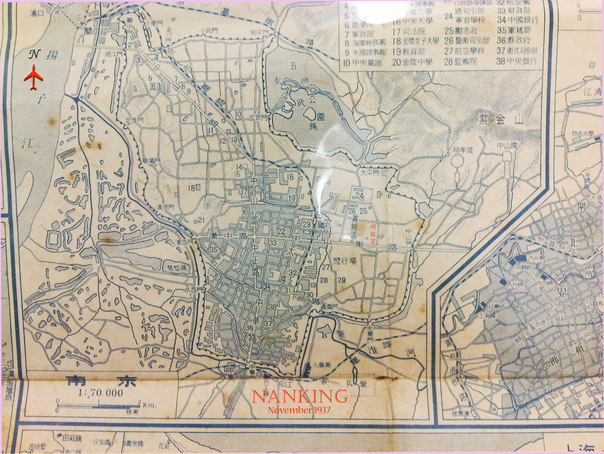
This digital image was taken from a Blackberry mobile phone, with English title and map orientation added. Also added is the name 明故宮 (palace of the Ming dynasty) on its site to the west of 中山門, based on a Chinese city map of 1936.
| To Bibliography |
This digital image was taken from a Blackberry mobile phone, with English title and map orientation added. Also added is the name 明故宮 (palace of the Ming dynasty) on its site to the west of 中山門, based on a Chinese city map of 1936.
| To Bibliography |